
Satellite communication for lorries out of network
A Teltonika use case: lorries that head into places with no cellular network are fitted with an FMC125 tracker or one from the FMx6 series plus a satellite modem, so the vehicle stays in contact and the panic button works at any point on the route.
A Teltonika use case: lorries that head into places with no cellular network are fitted with an FMC125 tracker or one from the FMx6 series plus a satellite modem, so the vehicle stays in contact and the panic button works at any point on the route. In town nobody gives coverage a thought: 4G is everywhere, and in places 5G is already being tested. But drive away from the big cities and the signal starts to fail even in developed countries. Hills and mountains block the masts, and in deserts and on plains there are simply no masts for hundreds of kilometres. For a logistics business, missing points in a report are the least of the troubles. A driver in difficulty in an area with no coverage cannot call for help, and the company does not know where he is. Teltonika solves this with a satellite channel that switches on only when there is no cellular network.
What this scenario solves
Outside the big cities mobile coverage weakens quickly, and in mountains and deserts there is none at all.
Lorries in areas without coverage become an easy target for robbers on remote stretches near borders.
The driver cannot call the emergency services, and the company cannot see where the vehicle is.
Without exact coordinates, rescuers spend hours looking for a vehicle over an enormous area.
Outside the big cities mobile coverage weakens quickly, and in mountains and deserts there is none at all. Lorries in areas without coverage become an easy target for robbers on remote stretches near borders. The driver cannot call the emergency services, and the company cannot see where the vehicle is. Without exact coordinates, rescuers spend hours looking for a vehicle over an enormous area.
The scale of the problem is visible on the GSMA coverage maps. In Africa with its deserts and savannahs, on the plains of Australia, in the forests of South America, huge areas remain without a cellular network. Operators invest in 4G and 5G where there are plenty of subscribers, while the old 2G masts out in the regions are maintained on whatever is left over. When a mast like that breaks, it may not be restored at all, and the blank spots multiply.
In Australia the areas without coverage stretch for hundreds of kilometres. Lorries carrying goods run through them, tourists drive through them, expeditions work in them. A hot climate, sharp changes in the weather and enormous distances to the nearest settlement mean that help may be several hours away.
A minor nuisance here quickly turns dangerous. Out of fuel, a broken suspension, the vehicle off the road — in an area with cellular coverage the driver simply makes a call. Without it he is left on his own, and the dispatcher learns of the problem only when the vehicle fails to arrive at its destination.
And finally the load. Commercial vehicles crossing remote border districts attract robbers precisely because calling for help from there is almost impossible. Both a valuable load and the driver’s life are at risk.
What Teltonika offers
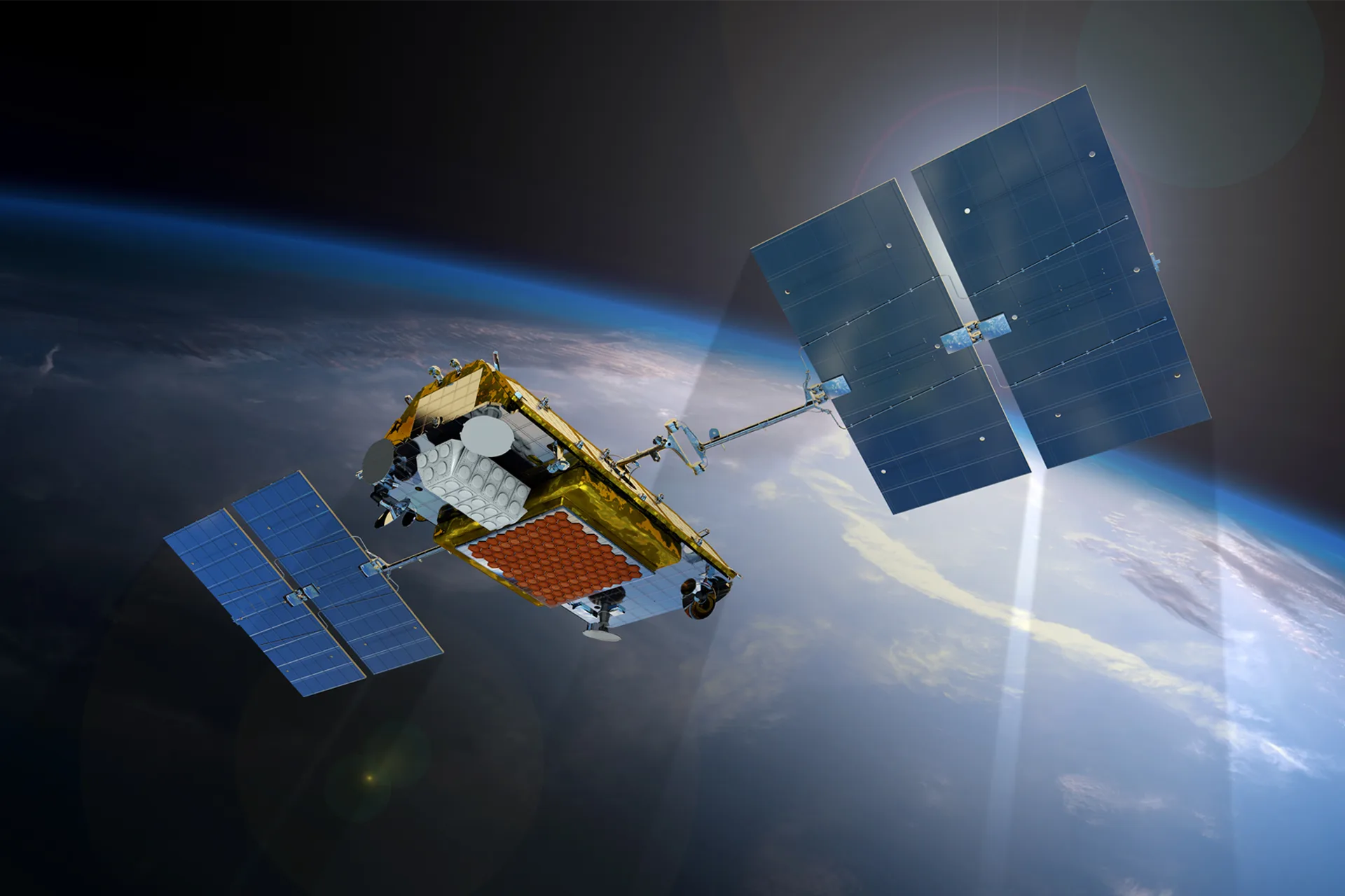
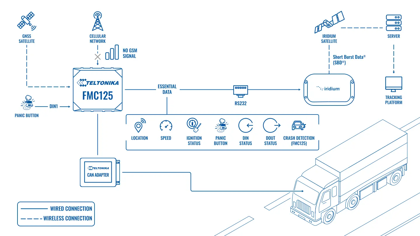
Teltonika proposes connecting a satellite modem to the vehicle tracker. While the vehicle is within cellular coverage, the data goes the usual way. When the network disappears, the modem automatically takes transmission over through a satellite channel that does not depend on masts or terrain.
Installation and setup
Fitting the device and configuring it for the fleet scenario at hand.
Data transfer
The device collects data and sends it to the monitoring platform; how often depends on the model and its settings.
Analysis and control
The person in charge gets reports and alerts and looks into what stands out.
Which trackers are suitable. The satellite modem works with the Teltonika FMC125 and with the FMx6 series.
• The FMC125 is an ADVANCED category tracker for the 4G LTE Cat 1 network: several inputs and outputs, a 1-Wire interface for driver identification and temperature sensors, support for a CAN adapter. It suits most commercial vehicles.
• The FMx6 series are PROFESSIONAL category trackers for heavy vehicles: FMS CAN data to the J1939 standard, fuel data over J1708, reading tachograph data in real time through K-Line, and other advanced functions. The choice for long-haul tractor units and plant and heavy equipment.
How the data is transmitted. The satellite modem uses a narrowband packet protocol for short messages. It is not intended for streaming video or frequent points, but it reliably delivers what matters: coordinates, time, alerts and the key parameters of the vehicle. The modem transmits only when the tracker cannot send data over the cellular network, so expensive satellite traffic is used sparingly.
The panic button. The heart of this solution is the SOS button in the cab. The driver presses it, the modem activates and sends a signal with the tracker’s exact GNSS coordinates and the other data programmed in advance for such a case. Rescuers and the dispatcher know where and when the event happened and do not spend hours searching.
Automatic accident detection. The FMC125 has a scenario for detecting a road traffic accident from a sharp impact. If the vehicle has been in an accident and the driver and passengers cannot press the button, the tracker will send the alert itself. In an area without cellular coverage it goes out over satellite.
An episode on a route. A lorry is running along a desert road; the cellular network disappeared two hours ago. The vehicle is cut up and an attempt is made to stop it. The driver presses the button, and a minute later an alert with coordinates is on the dispatcher’s screen. The company passes the location to the police immediately, instead of waiting for the vehicle to fall off the schedule.
How the channels are divided. The cellular network remains the main one: all the points at the usual interval, the CAN data and the sensor data go through it. Over satellite go the alerts, the SOS button and occasional check points, whose interval is set to suit the satellite operator’s tariff. The tracker carries on keeping all the records in memory and sends them when the cellular network comes back, so the detailed history does appear in the report for the run, if with a delay.
The loss-of-coverage scenario. The network has gone: the tracker writes points to memory, and the satellite modem transmits only the selected events. The network is back: the memory is unloaded over the cellular channel and the satellite falls silent. This chain is tested on a trial run before launch, including pressing SOS in an area with no cellular coverage.
What the dispatcher sees on an ordinary day. The vehicle stays visible on the map along the whole route, even if in areas without a cellular network the points arrive less often. Long stops, departures from the route, CAN data and other configured events reach the dispatcher even when the driver is far from the masts.
What you get
Contact where there are no masts
The satellite channel transmits data from districts with no mobile network, where an ordinary tracker stays silent.
Satellite traffic only when it is needed
The modem switches on when the tracker cannot send data over the cellular network, and does not waste expensive traffic.
Automatic switching
When the cellular network is lost the modem picks transmission up itself, and when the network appears again it hands it back to the usual channel.
Works in any weather
Vehicles stay visible on the map in poor weather conditions, when cellular coverage out in the regions is particularly unreliable.
Quick help for the driver
The panic button and automatic accident detection pass the exact place of the incident to rescuers and the dispatcher.
Why this solution
For Teltonika the satellite modem is an addition to the familiar trackers, not a separate system. The same FMC125 or FMx6 series tracker works on the vehicle with all its functions: CAN, tachograph, sensors, event scenarios. The satellite channel simply covers the stretches of the route where there is no cellular network.
This solution is not for everybody. Satellite traffic is noticeably dearer than cellular, and a narrowband channel is not designed for frequent points and large volumes of data. If a vehicle only occasionally loses the network for half an hour, the tracker’s memory is enough: the points are saved and go out when contact returns. Satellite is needed where waiting is not an option: routes through unpopulated districts, dangerous goods, a risk of attack, work in places where help takes hours to arrive.
How this works in Azerbaijan. Inside the country most main roads are covered by the Azercell, Bakcell and Nar networks, but there are stretches where the connection goes: the mountain roads of the Greater Caucasus beyond Guba, Gusar and Sheki, the passes in winter, some of the roads in Nakhchivan, the districts being rebuilt in Karabakh and East Zangezur. For hauliers running along the Middle Corridor through Kazakhstan and Turkmenistan to China and Central Asia, long desert stretches without coverage are an ordinary part of the route. In such cases a satellite modem is added to the tracker, and for Azerbaijan we look at satellite communication. When rolling this out it is worth deciding in advance which events to send over satellite and which to hold until the cellular network returns, and testing the SOS button before the first run. GPS.az fits the tracker and the modem, configures the alert scenarios and brings the data onto the Wialon platform, where the dispatcher sees the vehicle along the whole route.
Related case studies
Related rollouts and equipment

Questions about the “Satellite communication for lorries out of network” scenario
Request a call
A specialist will call back and match a solution to your fleet and your task.