
Protecting and monitoring charter yachts
A charter company keeps watch over the yachts its clients hire: the FMC125 tracker reports the position and the state of the vessel over the cellular network and, well away from the shore, switches to a satellite modem.
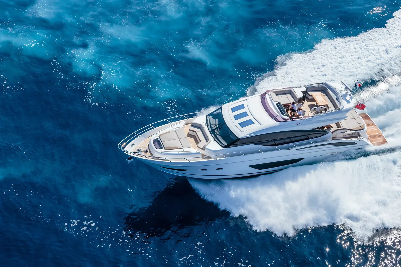
A charter company keeps watch over the yachts its clients hire: the FMC125 tracker reports the position and the state of the vessel over the cellular network and, well away from the shore, switches to a satellite modem. A yacht is handed over to people the owner meets once in his life. Some clients sail the vessel themselves, without a skipper, and head for places with neither people nor mobile coverage. For the owner that means the risk of theft, of a hidden accident, of excess fuel consumption and of wear he only learns about at the end of the season. In this scenario Teltonika assembles a system on board that shows where the vessel is and what state it is in at any point of the route, that can raise an alert if it is stolen and that gives the crew a panic button in case of trouble.
What this scenario solves
A yacht on charter goes far from its base with a crew nobody knows.
Outside mobile coverage an ordinary tracker falls silent and the owner loses sight of the vessel.
Theft of marine equipment and gear costs owners tens of millions of dollars a year.
Without monitoring, the cost of fuel and of maintaining a vessel can more than double.
A yacht on charter goes far from its base with a crew nobody knows. Outside mobile coverage an ordinary tracker falls silent and the owner loses sight of the vessel. Theft of marine equipment and gear costs owners tens of millions of dollars a year. Without monitoring, the cost of fuel and of maintaining a vessel can more than double.
The market, meanwhile, is growing. The global yacht charter market in all its forms — crewed, bareboat, skippered and by the cabin — was valued at 7.22 billion dollars in 2022. Forecasts put it at 11.06 billion by 2030. More yachts on hire means more risk for owners.
Teltonika quotes an estimate: hundreds of millions of dollars' worth of marine property is stolen every year, with direct losses of about 60 million dollars a year. Thieves are interested both in the vessels themselves and in what is on board: engines, electronics, jet skis, tenders.
There is also a peculiarity of the industry. A charter company usually does not own its fleet; most yachts belong to private owners who hand them over to be managed. A vessel may be chartered with a crew, but more often it goes to a client who sails it himself. At home or on an international passage, the risks for the owner are the same: he cannot see where the yacht has gone, how it is being handled or whether anything has happened to it.
Finally, the sea does not forgive weak equipment. A tracker on a yacht lives in salt, damp and spray, and the connection is needed where there are no cellular masts at all. An ordinary vehicle tracker is unsuitable for this, both for its housing and for its communication channel.
A separate headache is arguments with charterers. The client brings the yacht back with a scratched hull, an empty tank and a broken engine, and insists that everything was within normal limits. Without a history of the route, the speed and the engine hours, the owner has nothing to put to him and pays for the repair himself. It is just as hard to prove that the vessel entered a prohibited area or anchored where anchoring is not allowed.
What Teltonika offers
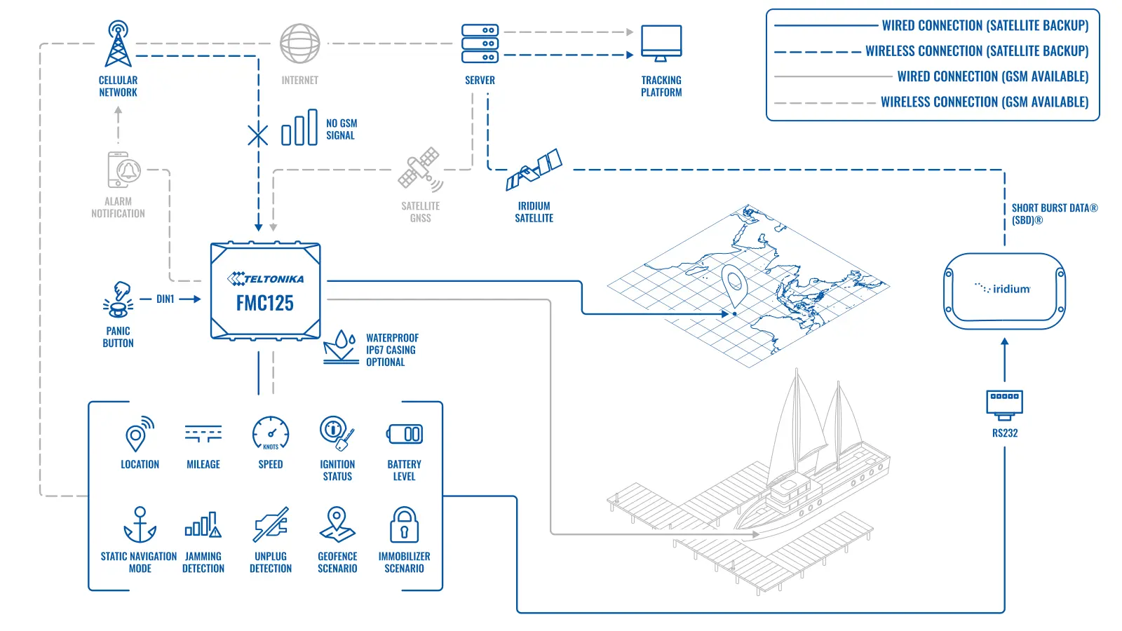
The basis of the solution is an FMC125 tracker in an IP67 housing with a satellite modem connected over RS232: near the shore the data goes over 4G, in the open sea over the satellite channel, so the owner can always see the yacht.
Installation and setup
Fitting the device and configuring it for the fleet scenario at hand.
Data transfer
The device collects data and sends it to the monitoring platform; how often depends on the model and its settings.
Analysis and control
The person in charge gets reports and alerts and looks into what stands out.
The FMC125 works on a 4G LTE Cat 1 network, has an RS232 serial port and several inputs and outputs for sensors and actuators. For use at sea it goes into a protective IP67 housing, which stands up to spray and brief immersion. The satellite modem in this scenario is likewise built for marine conditions.
Positioning. The tracker fixes its position by GNSS regardless of whether there is a cellular network around it. The company sees its whole fleet on one map in real time. The FMx125 series has a static navigation mode: when the yacht is at a berth or at anchor, the tracker discards the jumps in position, and no false movements appear on the map.
The satellite channel. When there is no cellular network, the FMC125 sends its data through the modem connected to the RS232 port. It uses narrowband packet transmission of short messages, which is enough for positions, statuses and alerts. Reports on the state of the vessel therefore arrive from any point on the route. An example from the case: an owner in Sydney has chartered his yacht to a client who is sailing along the coast of France, and in an accident or a serious equipment failure he gets a notification at once with the time, the place and the nature of the incident.
Geofences. Automatic and manual geofences are configured in the tracker (the Auto Geofence and Manual Geofence scenarios). If the yacht leaves the permitted sailing area, or leaves its berth without permission, the owner gets an alert. The same function shows when a client has departed from the agreed route.
Protection against theft. The tracker recognises signal jamming and a disconnection of the power supply. For that case a siren, a notification and an immobiliser scenario that blocks starting of the engine can be configured.
The panic button. A button for the crew is fitted on board. If something happens, a person presses it and the signal, with the FMC125's exact position, goes out over the cellular network or, in its absence, through the satellite modem. A predefined set of data can be sent along with the alert. The shore services get the exact place and time of the signal and waste no time searching.
Power and fuel. The tracker watches the voltage of the vessel's battery constantly and warns if it is going flat. Away from the shore that is a matter of safety. For fuel monitoring, a fuel level sensor — an Escort, for instance — is connected to the AIN1 analogue input, which gives notifications about drains, unusual consumption and the tank being opened.
Property on board. Jet skis, tenders and inflatables can be fitted with Teltonika trackers of their own or with EYE Beacon units. The same scenarios work for them: position, geofences, notifications on start-up.
What this looks like at night. The yacht is in a marina; the client handed it back that evening. At three in the morning the tracker registers movement beyond the berth, and then a sign of cellular jamming. The owner gets an alert with the position, the signal is duplicated through the satellite modem, and the engine is blocked by the immobiliser scenario. The marina's security and the police get an exact place rather than a vague notion of somewhere in the bay. Even if the thieves strip the equipment off the yacht, the tracker will go on reporting its position for as long as it has power from the back-up battery.
Deployment usually follows one pattern. First a place is chosen for the tracker and the antennas, so that the hull and the mast do not block the sky. Then the power supply, the panic button, the fuel sensor and the cut-out relay are connected, and the geofences of the permitted sailing areas and the recipients of the alerts are configured. The last step is a trial passage, on which the switching between the cellular network and the satellite is checked.
What this tracker is not. The FMC125 shows the owner where the vessel is and what state it is in, but it does not replace marine navigation, AIS, a VHF radio or the vessel's own life-saving equipment. The panic button sends a signal to the people you have named in the settings, not automatically to a rescue service, so the procedure for passing the signal to the shore services is written down in advance. The range of the cellular network from the shore depends on the place, the operator and the height of the antenna, and is checked on a trial passage. The tracker and the modem take their power from the vessel's electrical system, bearing in mind that at a berth the battery is not being recharged.
What you get
Built for the open sea
The FMC125 in an IP67 housing and a marine satellite modem stand up to salt, spray and bad weather.
A connection at any point of the route
When the cellular network drops out the tracker switches to the satellite channel by itself, the yacht does not disappear from the map, and the crew has nothing to press.
An alert when a vessel is stolen
Geofences, jammer detection, power disconnection and blocking of engine starting give a chance to stop the theft rather than search for the yacht afterwards.
Control of fuel and of the property on board
A fuel level sensor shows drains, while EYE Beacon units and separate trackers protect the jet skis and tenders.
A panic button for the crew
A distress signal with an exact position goes out even where there is no mobile coverage.
Costs under control
The history of routes, engine hours and fuel consumption helps to plan maintenance and to work through disputed cases with clients.
Why this solution
For yachts it matters that the tracker works without a cellular network and stands up to the marine environment. With Teltonika that is covered as standard: the FMC125 with RS232 works with a satellite modem over a standard interface, and there is an IP67 accessory housing for it. There is no need to assemble a system out of mismatched units.
The tracker's firmware already contains the scenarios an owner needs: geofences, jamming detection, power disconnection monitoring, an immobiliser, a panic button, static navigation. They are enabled and configured in the configurator, with no custom work.
Data from the FMC125 is accepted by the common monitoring platforms, including fleet management systems, so the yachts can be followed in the same window as the rest of the company's vehicles. The FMC125 has spare inputs for additional sensors, so the system can be extended as the need arises.
An honest limit: the satellite channel is slow and charged for by the message. It is not the place to push a stream of positions every few seconds; the usual set-up is infrequent positions in the open sea and instant sending of alerts.
What the owner ends up with. After every charter he has a track with the bays visited and the anchorages, the engine running time, the fuel consumption, the occasions when the vessel left the permitted area and the history of the battery voltage. That data makes it convenient to calculate real wear, to plan engine servicing by engine hours rather than by the calendar, and to put well-founded claims to the charterer. For a management company it is also an argument in negotiations with private owners: it can show exactly how their yacht was used over the season.
How this works in Azerbaijan. We have no large charter market of the Mediterranean kind, but the scenario is in demand with the owners of private yachts and motor boats in the yacht clubs of Baku and Absheron, with hire companies on the coast at Nabran, Mardakan and Shuvelan and on the Mingachevir reservoir, and with companies whose vessels service the offshore oil and gas facilities. Near Baku and along the coast the Azercell, Bakcell and Nar coverage is generally steady, but a few dozen kilometres out from the shore there is no network, and routes like that need satellite communication. The Caspian is less salty than the ocean, but damp and swings in temperature still kill unprotected electronics, so an IP67 housing and properly routed antennas are essential. For pleasure boats on the Mingachevir reservoir or in Baku bay a satellite modem is usually unnecessary: the cellular network is enough there, and an FMC125 with a fuel sensor and a geofence of the water area will do. In winter, when the boats are ashore, the tracker is useful as protection against the theft of engines and equipment. GPS.az fits the FMC125 to vessels, connects the fuel level sensors, the panic button and the immobiliser, and sets up the water area geofences and the notifications on the Wialon platform.
Related case studies
Related rollouts and equipment


Questions about the “Protecting and monitoring charter yachts” scenario
Request a call
A specialist will call back and match a solution to your fleet and your task.